This is a sequel to the previous post where we mentioned the possibility of estimating heat flux divergence between two ADCP/XBT lines converging on Bermuda, one the Oleander section from New Jersey, and the other a new line from Jacksonville, FL. Here we give a brief synopsis of what we learned from an analysis of the oceanic Glorys12 data set and the ERA5 air-sea heat flux estimates.
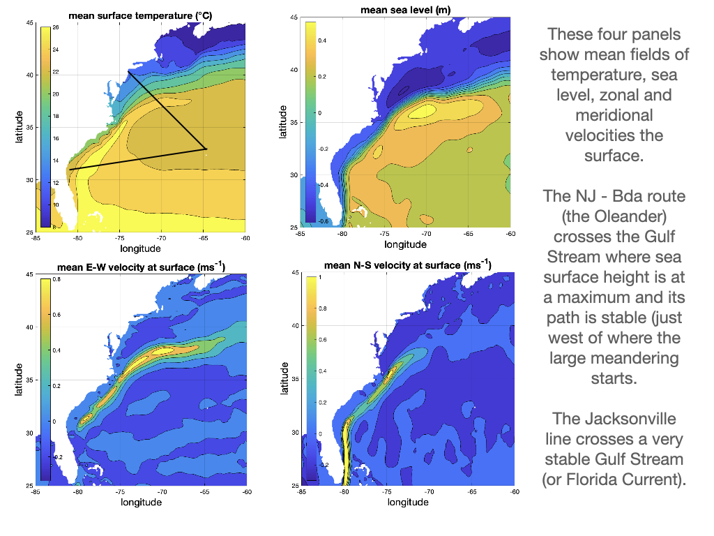
The analysis has far more detail than can be included here, but a few figures will set the stage. The first figure shows the 33-year mean surface fields from Gloyrs12. The Gulf Stream shows up as a sharp front in the south where its path is tightly confined, and as an increasingly blurred feature to the east after passing Cape Hatteras.
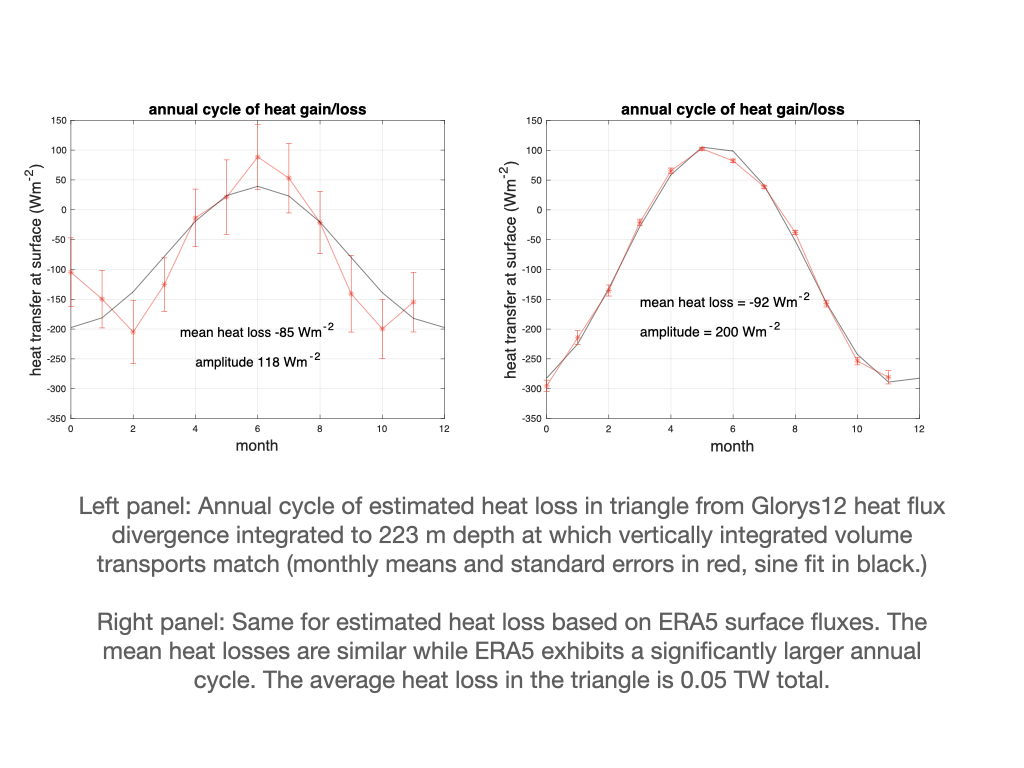
Heat transport across the two lines is estimated from the surface to 223 m at which depth the volume transports are the same at 16.7 Sv. The difference = 0.05 PW heat loss over the triangle amounts to about -85 W/m2 heat loss.
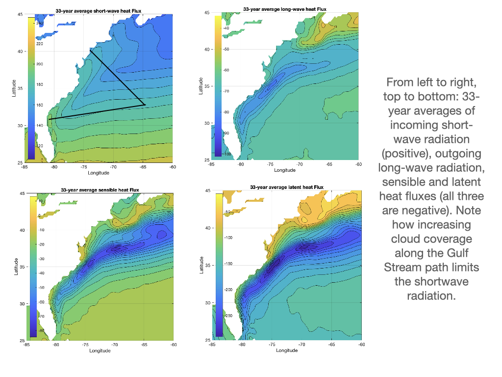
The second figure shows the 33-year ERA5 reanalysis fields of incoming shortwave radiation, and the 3 outgoing heat losses: longwave radiation, latent and sensible heat.
The area averaged heat loss = -92 W/m2. I did not expect them to agree this closely. I can add standard errrors, but for what purpose? These would be numerical and tell us nothing about the underlying accuracy or quality of the data. Thoughts and comments are welcome.
The final figure shows the annual cycle, which is much larger for ERA5 than Glorys12. This may be because the atmospheric and satellite data are far more complete than the data available for the Glorys12 reanalysis (largely limited to sea surface height and the occasional Argo profile). Is there a way of knowing if Glorys12 uses the extensive multi-year Oleander XBT data set?
What does this suggest with respect to a possible Jacksonville - Bermuda operation? First and foremost, establish an XBT operation - at least monthly and perhaps in the beginning biweekly to build up an initial dataset that can inform us about variability on faster time scales. We will want to measure currents directly for although the Gulf Stream appears to be quite stable here, we don’t know how well altimetry can reproduce the current here, not to mention the mean flow offshore of the Gulf Stream. Does the Antilles current reach this far north to join the Gulf Stream (is it seasonal)? Farther offshore the mean flow is weakly to the south (what Joe Reid years ago referred to as the C-shaped circulation). There is so much to be learned!
This work will not be published but I have a .pdf file with more information about the analyses if you are interested or want to explore this further. You can reach me at trossby@uri.edu.