When you fly west from Scandinavia try to get a window seat on the right side away from the wing. The reason is that they (especially Icelandair) often fly along the southern coast of Iceland continuing southwest across the southern tip of Greenland. You might see Greenland from a left side window too, but you’ll be blinded by the sun. If it is a clear day I guarantee you’ll be in for a big treat.
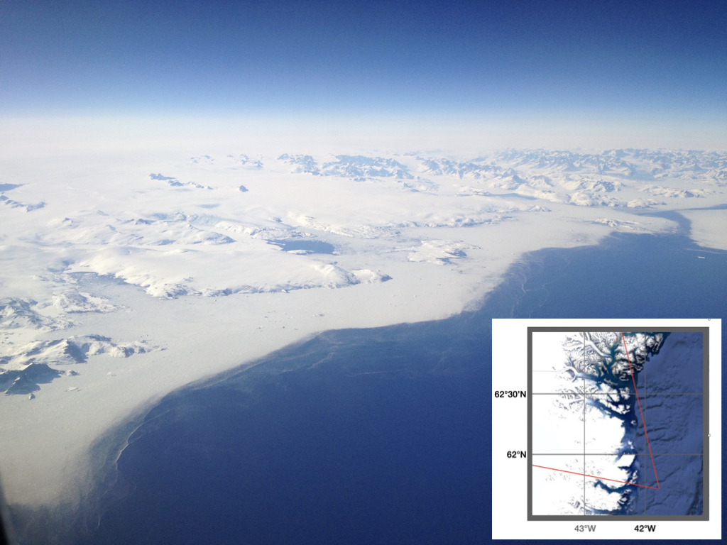
While I’ve never put my foot on the ground in Greenland I’ve flown over it many times so have gazillions of photos of the solid Greenland ice mass, of glaciers breaking up in the fjords, and of drifting icebergs. Here’s one, taken May 3, 2016 at 17:37 GMT or 2:37 PM local time. It may not be my most exciting photo, but it gives a good overview.

The GPS on the camera (GPS often works at the window) recorded my position as 61°41’N 41°53’W. The red lines on the map indicate the approximate field of view, I’m looking NW. You can see the solid Greenland ice mass in the distance although the haze results in a diffuse horizon. In the center there is a blue hole or polynya in the sea ice presumably due to a concentration of offshore winds there, perhaps steered by the coastal escarpment to the left? If you zoom in beyond the polynya you’ll see glacial ice sliding into the fjord. The white band along the coastline must be a dense slurry of drift ice. It is continuous everywhere except for a break in the north. At first I thought this reflected a river outflow from a fjord except that there is drift ice farther inshore. Even farther into the fjord there appears to be open water. Most likely all this reflects the action of winds somehow. Icebergs of various sizes are embedded in the drift ice. In the lower left corner two table icebergs look to be trapped or blocked by the rocky outcrops nearby. The transition drift ice to open water appears to be sharp, but a closer look will reveal thin sheets of drift ice with edges of bright bands of ice perhaps reflecting convergent flow in the water. At the right edge in the north there is a narrow long object that looks like a ship, but it must be an iceberg.
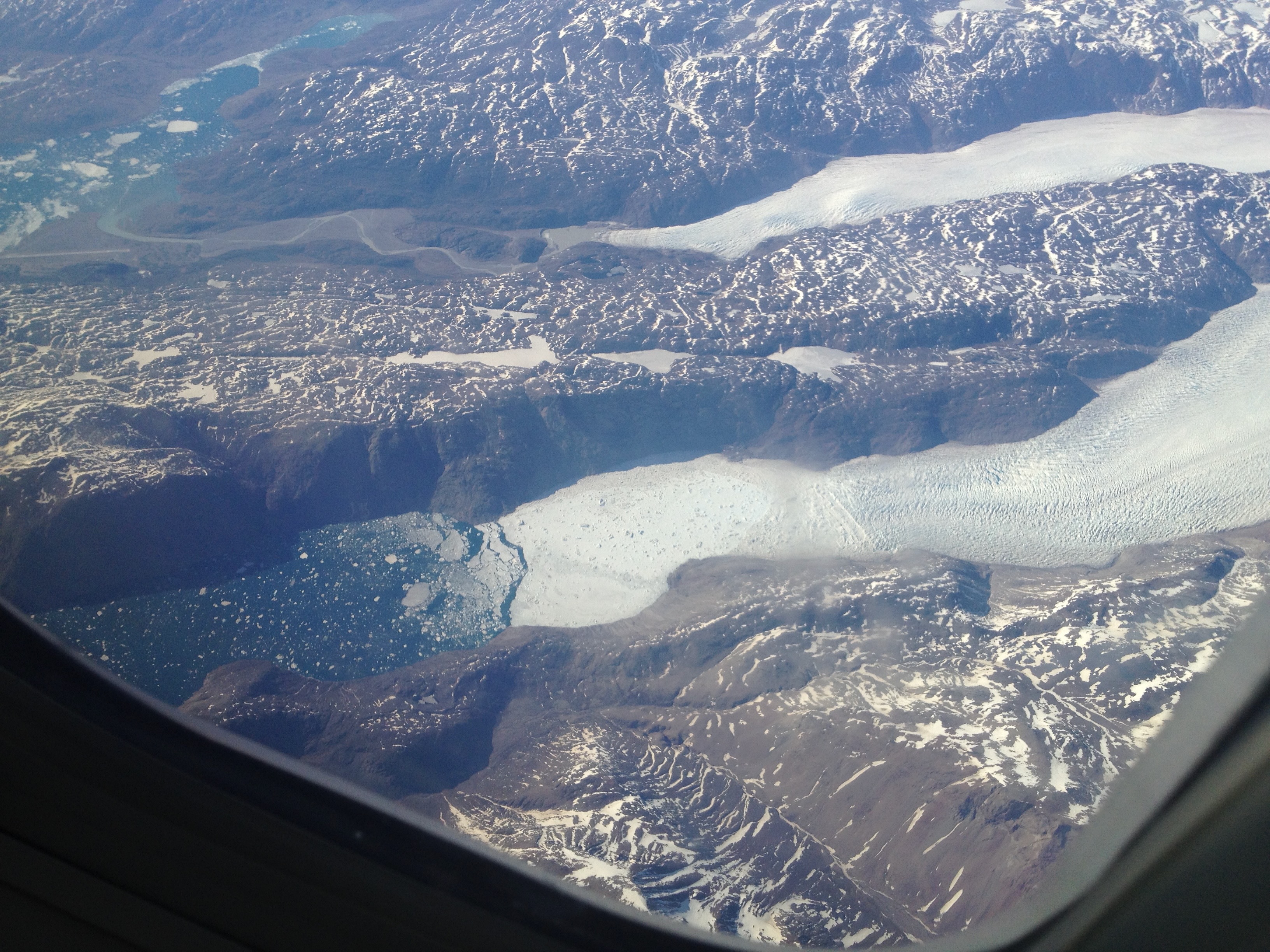
A few minutes later, after crossing the solid ice mass, we flew over an extensive network of glacial outflows and fjords in the southwestern corner of Greenland. We’re at about 61°06’N 45°00’W in this photo looking northwest. You can verify this with Google Earth Pro.

It gives a good view of two glacial flows, one breaking up into numerous icebergs floating in the fjord and the other producing meltwater that feeds a river in the upper left. It flows out into a larger fjord with large chunks of ice floating about. Next to the river you’ll see the runway of the Narsarsuaq International airport. Besides the fact that you can fly there from Reykjavik, the airport serves as an emergency airport for trans-Atlantic aviation. It played a huge role as a steppingstone for aircraft during WW2. The resolution isn’t good enough to see the buildings in the area. In preparing this I learned from Google Earth Pro that the dark color just south of the runway is a forest, there is even an arboretum there! I also learned that Erik the Red’s Brattahlid (‘steep slope’) settlement beginning around 985 AD is on the other side of the fjord just outside the field of view. According to Wikipedia the settlement grew to as many 5000 inhabitants, many coming to escape overcrowding in Iceland. I knew about the settlement, this is famous stuff, but had only a rough idea of where it was located. Now I know!